The Cost of Living in the Age of Climate Change

By Alaina Mathew

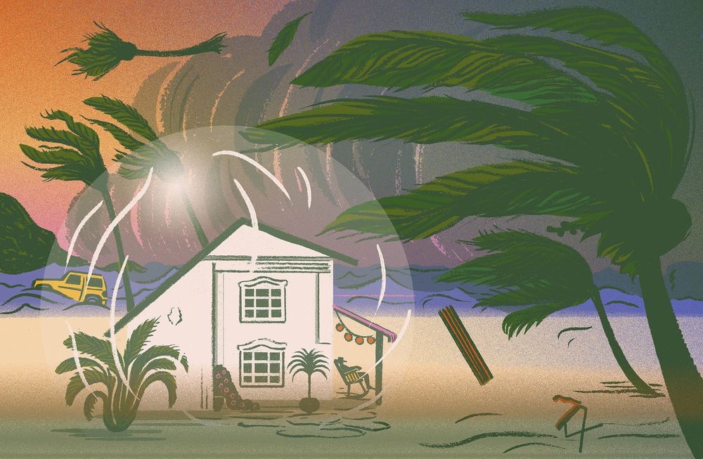
After countless stressful hours of trying to figure out what my research topic would be, I was finally getting somewhere. Dr. Esprit helped in figuring out what I should focus on, and that was my Community; Salisbury.  My topic focuses on the economical impacts of climate change in the village of Salisbury, post hurricane Maria. I created a Google map and pinpointed various businesses and farming grounds that had been affected by the hurricane, and how it affected the community’s economic development. 

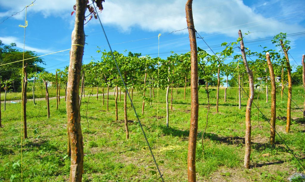
Throughout this semester, I have done additional readings relating to the topic and educating myself on agriculture. As Salisbury is a community built on farming, it was important for me to find out how the hurricane had affected crops. I have also partnered with a fellow intern on a new project. We have been doing extensive research on underground farming and how it can be beneficial to Dominica. With Dominica being reliant on agriculture, underground farming can create a more sustainable and only for us as it does not rely on sunlight and other natural factors to grow crops. With the use of hydroponic technology, we would not have to rely on seasons for producing crops. It also provides food for the country in the event of natural disasters. This would make the island self-sufficient, and not rely solely on ground crops and other plants. 

I have also been working with the ArcGIS software, and familiarizing myself with it. It had been a bit difficult in the beginning when it came to mapping specific locations, but it has gotten easier with time. It Is quite amazing to see how the work we have been throughout the semester (simple things like filling out addresses for a spreadsheet) link together and form a bigger picture. It was with this information that we were able to build these maps and locations on ArcGIS. 

I hope to continue working with my partners on our underground farming project because I believe that it could be very successful in Dominica and change the way in which we view agriculture. I will also continue working on the map on ArcGIS, and finishing up all assignments that I have been assigned.

Climate Resilience

By Ashante Matthew

Create Caribbean is a safe haven for its interns at the Dominica State College. We get the opportunity to conduct research on our chosen assignments which will contribute to the carisealand project. During my first year of being an intern at Create Caribbean, I chose the topic Environmental Law and Policies. Within my topic I focused primarily on the laws that help to protect our environment and wildlife not only from climate change but also from persons who seek to lay waste and despoil our environment’s natural features.  

In the course of semester 2, I decided to concentrate mainly on the Climate Resilience Act 16 of 2018. This act was drafted after the island was devastated by the severe events of hurricane Maria. For those who aren’t aware, climate resilience deals with the ability to anticipate, prepare for, and respond to hazardous events, trends, or disturbances related to climate change.   Improving climate resilience involves assessing how climate change will create new, or alter current, climate-related risks, and taking steps to better cope with these risks.

Therefore, I conducted research on the aims of this act, persons responsible for executing this act and most importantly how this act will aid in the protection of our nation against the devastating effects of climate change in the near future.  However, conducting research on this act has proven to be challenging at times since it is new and there is not much information disseminated about this act. Morover, the aspects which are available to the public state very little on how the country’s government officials are planning on executing their claim to make Dominica the first climate resilient nation.

Being an intern at the Create Caribbean Institute has helped me to grow academically since  I am constantly being exposed to different learning techniques and skills from various software programs such as ArcGIS.  This institute has also helped me develop my research skills. I am now more capable in conducting research because I am aware of where I need to go to find certain information relevant to my topics, and even when I falter and appear lost at times there are persons available to assist at any given time whether it is the create students or the Create Caribbean management.  In conclusion, Create Caribbean helps mold their interns for the real world so that we are more suitable to handle the challenges that life is going to continuously throw at us.

Create Caribbean through the Eyes of Creators

By Rennick Stevens

I will be honest, I did not know anything about Create Caribbean when I decided to join.  I blindly signed up for something I had no knowledge about.  So you may ask, “what made you join Create?” I was introduced by a friend who knew a friend who had some ties to the institute. However, since the day I signed up to be an intern at Create Caribbean I have never looked back and regretted it.

As time passed I learnt what it really meant to be part of an amazing group. Like a friend would always say, “you guys are a bunch of effective people”, so I can say that Create Caribbean is an effective group of people. You really learn a lot from both the institution and your peers. From deep research to sharpening writing skills and from public speaking to just being able to make friends, Create Caribbean has a lot to offer.

Computer science and business administration are my focus. My majors are a plus for me as an intern because as often emphasized at Create, research and technology go together. The greatest experience for me was being able to teach children in the summer at Create and Code 2019. Additionally, I was given a topic to do some research and to present my findings on ‘Public Health and Pollution’. I can truly say I’ve learnt a lot from doing research. Most notably, I’ve learnt that most of the habits that we have cause our own demise and destruction. However, In doing research I encountered many challenges. For example, there was a serious lack of information on my topic and at times it was difficult to determine the validity of sources. But that didn’t deter me; I was still able to complete my project.

What an experience I have had so far at Create Caribbean. There is never a dull moment at Create Caribbean. The interns and administration become your family and it feels like a home away from home. I am extremely proud to be a part of this institute, a place where I developed into the best version of myself.

My Carisealand Experience

By B. Melissa E. Santiago 

 According to http://carisealand.org  Carisealand is a digital research and community-inclusive project of Create Caribbean Research Institute, the first digital humanities center in the Caribbean. 

This semester I mainly reviewed the information that was on the excel page named Carisealand resources for environmentalism and sustainability. I completed two abstracts for my project from last semester. I also did research and got some information that could back up the points from my project for Marine Life and Global Warming, and cited it to add on to The Carisealand Syllabus.

  I had to work on ArcGIS for the mapping part of Carisealand. I had to ensure that the points on the map in arcgis were placed in the correct location. This is so because after the information was moved from its previous platform some of the information was messed up and the points moved location. The points on the map were the location given in the Carisealand resources for environmentalism and sustainability document. I was given two islands to look over, French Guiana and Dominican Republic.

 I would say I’ve been successful in the research aspect of the project. But I’ve fallen short when it comes to ArcGIS program. I’ve watched the tutorial done by Miss Espirit countless and tried getting help from some other create members (creators) such as Tracey and Shalian. I’ve tried to make some changes but up to these day it doesn’t seem to save. Since I no longer have a laptop the time for me to contribute to the project has been limited to when I have the create laptop. Which I have been using for the pass few weeks. 

  I been learning how to operate ArcGIS and other programs thanks to this project. My research skill have also gotten a lot better , I’ve learnt about the different sites, and ways in which research is done.

 I hope that with the free time I have now due to quarantine I can get a handle on ArcGIS and be able to actually complete my part of the project. I also hope to learn how to code with one of the creators named Kodie.

The Impact of Climate Change on Tourism in Dominica

By Serena Maxwell

The Carisealand project is an initiative which aims to illustrate the effects of climate change on the Caribbean region. It is imperative that climate change is thoroughly understood, as the effects of this global phenomenon are felt in every aspect of life. One area which has been severely affected by climate change in the Caribbean is the economy. As an Economics major, this was of special interest to me and so I decided to focus my research on the economic impacts of climate change. In Dominica, tourism is one of the major contributing sectors to the gross domestic product (GDP). Tourism is an economic driver in Dominica and as a result of this, it is important that the impacts of this phenomenon be assessed. 

One of the effects of climate change is an increase in the frequency and intensity of hurricanes in the Caribbean. In 2017, Dominica was devastated by the passage of the category 5 hurricane Maria. This resulted in the loss of millions of dollars in revenue which is generated by the cruise tourism in Dominica. My research assessed the implications of the hurricane as well as the measures which could be undertaken to curb the impacts of future events such as these. The findings of the research conducted revealed that the passage of the hurricane damaged approximately 80% of the infrastructure in the country while 256% of the GDP was destroyed. This research has shown that a greater effort must be made to combat the effects of natural disasters by implementing measures such as altering the building codes to create stronger infrastructure. 

This semester I further contributed to this study by including additional sources to the Carisealand syllabus. The scope of the study was also expanded the to assess the impacts on the blue economy as well. The blue economy refers to the sustainable use of the ocean, seas and coastal resources in order to promote economic growth in the country. The research revealed that through the use of sustainable environmental practices such as the decrease in activities such as overfishing and polluting of water bodies, the effects of climate change can be mitigated. 

Throughout the course of this research, I have successfully been able to gather information pertaining to my topic, which is greatly due to the abundance of available literature. Numerous studies have been conducted which illustrate the effects of climate change as well as suggesting measures to suppress the effects of this occurrence. This research has aided in developing my technological skills as I have gained knowledge and expertise in utilizing software such as Storymap, that I would not have otherwise been able to use. As this study progresses, I aim to expand the scope of this study to focus on the sustainable measures which could be implemented to alleviate the impacts of climate change.

New Software, New Opportunities

By Kaila-Ann Guiste

This semester, our assignments issued were abstracts and reference pages for research projects done for Carisealand as well as mapping the locations of the reference centers in the region on the ArcGIS software. The video of instruction about ArcGIS provided a very clear routine of activity for fixing the points as well as the workings of ArcGIS. Upon loading ArcGIS, the software got easier to handle the more time that was spent with it. Practicing to use it as well as doing any point adjustment was very challenging. As usable as the software was, the computer used was in no condition to handle the program and kept crashing. Observing someone else using the program was beneficial towards being accustomed to it but the inability to use the program effectively made completing any point reassignment impossible. This was coupled with  the lack of Wi-Fi at home and Wi-Fi issues at the Create space (recently fixed). This was the only assignment that applied to me since have not yet done my research contribution to the Carisealand project. 

I did a research presentation with a few other Tourism and Hospitality majors for a conference in Martinique called My Earth, Our Earth, A Nugget to Preserve. The research questions asked, “Can Our Traditional Architecture Better Withstand the Impacts of a Category 5 Hurricane?” This coincides with the questions involved in the relevant topic Culture, Information, and Heritage. In this project, we analyzed the strengths and weaknesses of the traditional architecture present in buildings in Roseau. These buildings portrayed the influence of French and English colonization and having withstood the test of time, some of these buildings also withstood a category 5 hurricane. We went around town to estimate the ages of these buildings, the preservative measures as well as the structures that made them resilient. There are still questions we did not emphasize on though we may have touched it briefly such as how these features can be morphed into modern homes without disfiguring them, how the functionality could be alternatively derived, and how and why we should retain these aspects of our culture. Including other questions, I believe that this study can be expanded to be my contribution to the Carisealand Project.

In my interactions with both activities, I developed an admiration for presentation software like ArcGIS and Visme. This opened my eyes to the possibilities of presentation forms further than power points and posters. In the conference, some countries used Visme showing a map of their countries with point that when interacted with showed pictures or videos and information. ArcGIS creates an interactive map of a specific collection of points on real world locations. These programs will definitely add value to my future presentations because now I know that there is more to it than what I knew. The only downside to this is that these are only functional in areas with good Wi-Fi reception. At the conference, a few countries were unable to present using Visme because of this.

The Challenges of a Small Island Developing State

By Kodie Jean-Jacques

Though my personal topic is ‘Community Poverty and Environmental Justice’, my fellow interns and I have been researching and presenting our findings on a wide spectrum of topics. From wildlife biodiversity to culture and heritage, to public health, to food and water security – it can certainly be said that we have imparted a lot of knowledge to the interested parties. 

Generally speaking, it is the impoverished communities who get the bad end of the deal as it relates to environmental justice. They are usually turned into the dumping sites, into industrial centers and are drained of their resources. In my research, I set out to find instances of environmental injustice relating to community poverty in the St. George parish in Dominica. For example, I focussed on the areas of River Street, Tarish Pit, and Stockfarm – just to name a few.

Notably, one of the most troublesome areas in conducting my research is getting secondary data. In some instances, the issue was plainly – ‘nobody has done research on this sub-topic as yet’. Whereas, in other instances, the issue was ‘we might have information on this but we don’t want to give it to you’. This proved to be very frustrating. However, not all efforts at attaining information were futile. Information was obtained from reputable international organizations such as the World Bank and private researchers who conducted their own research in Dominica and presented their findings. 

In addition to the digital research I have already conducted, I intend to create various questionnaires. These questionnaires will be circulated digitally and will entail questions relating to the quality of life in specific areas as well as median incomes and environmental threats within the St. George parish.

I can certainly say that my project has been helping me develop some critical skills. For example, I have improved at presenting my research and ideas into logical, coherent formats. Additionally, I’ve learned how to use various mapping and timeline software. 

The primary reason why I’m still so persistent at finding information for my topic is that I’m truly interested in it. I’ve always been fascinated by economic and political concepts and this topic is no exception. Moreover, the use of technology to fulfill objectives is something I’m certainly proud of and I aspire to continue doing such.

Creating thus far

By Shalian Shaw

During semester 2 of the 2019 – 2020 school year, us Create Caribbean interns have been given our respective assignments to contribute towards the Carisealand project. This semester we were mainly tasked with placing coordinates into the ArcGIS software and ensuring that these points were placed in their correct locations. All of this is because after the information was moved from its previous platform, some of the information was messed up and got misplaced etc. The locations being put into ArcGIS were from our intern assignments last semester. 

Navigating the ArcGIS software proved a tedious task for me personally as it was my first time using it. There were so many things I had to learn so that I did my work correctly and even after receiving a tutorial from one of my peers, I still had not fully grasped the concept. One specific lesson that I learned the hard way was that I had to click save after every point I put in so that a change was made. Nonetheless, I can now say that I am getting the hang of it. Another setback has been my time management. I have not contributed nearly as much as I would have liked to because of the demand of school as it is my last semester at the Dominica State College and the workload is heavier. I do plan though, to dedicate more time to the project as the semester winds down to a close. In that time, I wish to better learn the ArcGIS software, find more relevant information regarding the research topic and generally make meaningful contributions. 

My research skills were also broadened after having to do more research to add sources to our Carisealand syllabus. I learned what things I could do to better find the information I need and make researching easier. 

Despite the setbacks I am content with the fact that I have acquired new knowledge on ArcGIS and at the end of it all I can add it to the pool of technical skills earned while at Create Caribbean. These skills which I believe could be made the most of in the future.

How it's been

By Jerelle O’Brien

My first project at Create was to deal with food and water security linked to climate change. The work I produced reflected how climate change has increased the frequency and severity of hurricanes especially affecting the caribbean. I chose to highlight this aspect of the topic because of its effect on the food and water security of those affected by it. After a natural disaster, a lot of areas have difficulty accessing clean water and proper food. While doing this project, we produced weekly blogs on our findings and progress made on our projects. 

Food and water security globally is a 2030 sustainable development goal, another topic I learnt about before joining create but research more on after. Through this research and a missed opportunity for a competition, I decided to request permission of Dr Esprit to conduct a research project on building underground farms in order to facilitate in the achievement of this SD goal. Underground farming provides an innovative and safe way to ensure that food is grown and stored in times of need. 

My time so far as an intern has also helped me develop my knowledge in certain software such as Storymap, Adobe and ArcGIS. The programs used during the Create and Code summer camp has also been an interesting thing to learn, despite not having a full grasp on the concept. Learning these programs has not necessarily been easy. Technology has never really been my thing so manipulating these online resources took me a while to get used too. The carisealand project involves a lot of mapping and utilizing the arcGIS software. My contribution to the Carisealand Project involves the environmental resources present in the different islands of the Caribbean along with the production of the collection of resources I utilised for my projects. My hopes are to continue learning from all the opportunities Create provide and offer any ideas and further development I can to the institute.

The Work Continues: Learning New Tools

By Tracey Daway

Create Caribbean Inc. is a non-profit academic research and teaching centre in the Commonwealth of Dominica.  Aside from the effective and efficient administration at the centre, Create takes on interns yearly to assist with the more detailed tedious tasks.  The administration oversees our work on projects but tries to give us as much free movement over our methods and instruction as they can allow. Currently, we are working on the Carisealand Project.  Carisealand is a digital research and community project.  It’s purpose and aim is to explore the impacts of climate change and disaster in the region.  To imagine and possibly map out how our regional communities could deal with these issues to foster and build a more sustainable future that, according to Dr. Schuyler Esprit, will engage in sustainable living, community accountability and planetary responsibility.

This semester, we have been learning to use ArcGIS, it is a geographic information system for working with maps and geographic information.  Each intern has been assigned countries to work on. I was assigned the island of Barbados and Belize.  This aspect of the project is to essentially remap previous locations that had been already positioned on the map on our old site to our new site, with the move things have shifted and so we’re each going in to fix any issues with placement.  Learning to use the software is the biggest obstacle. I am not familiar with this field, however it does interest me. I like the technical aspect of it and the attention to detail. There have been many challenges with inputting data and I have not made significant progress to date.  As we continue working on this, I hope to get a better understanding of this software to utilise it with data input for my two countries. I would like to think of my contribution as an intern on this project as mapping, for now. The project is not far from complete but it is ongoing. I am moving at a reasonable pace with my mapping and I foresee a breakthrough soon.